
This year we went from Argentia to Port Aux Basques like other years, BUT, we added some new places in between that we hadn't done before. We usually drive about 900 km but this year we did 1250 km. It was a fantastic time as always.
Our trip usually goes like this:
Argentia to Clarenville, Clarenville to Gander, Gander to Badger
Badger to Deer Lake (or Howley), Deer lake to Serpentine Lake, Serpentine Lake to Robinson's, Robinson's to Port Aux Basques.
This year it went like this:
Argentia to Clarenville
(same as usual)
Clarenville to Gander
(same as usual with a big detour in Terra Nova due to a bridge being out)
Gander to Badger
(A different route this year including a long side trip that took us to a plane crash site from the 1940's. Most of the plane is still there)
Badger to Lomond(Badger to Deer Lake was the same and then we went to Lomond. It's about another 50 km North of Deer Lake just outside Gros Morne National Park. That part was all new for us. We arrived in Lomond just after dark)
Lomond to Corner Brook (This was completely new. We stopped in Burchie-Head, Woody Point, & Cox's Cove. It was a long day and we got to Corner Brook shortly after dark)
Corner Brook to Robinson's
(We drove through some trails that took us mostly through Corner Brook without having to ride on many roads so we didn't have to be trucked on a flat bed. One trail was kind of a goat trail but we all made it through with no issues, even the side by side)
Robinson's to Port Aux Basques
(Same as usual except we stopped at Codroy Pond)
2016 Newfoundland ATV Trip
Day 1 - Ferry Day
Road Trip. We are scattered around the province but the farthest had to drive from Bridgewater to the Marine Atlantic Ferry Terminal in North Sydney.

 |
| packing up the night before |
 |
| Attaching "Moosey" to the front bar |
 |
| Loading up the machines and getting ready to drive to the ferry The Magnificent Seven! |

 |
| I wonder how many people have taken a picture of this fried chicken joint! |
 |
| There's the ferry! |
 |
| Don't offload from a trailer when the ground is not level. [No machines or riders were harmed during the making of this trip] |
 |
| Waiting in the parking lot to board the boat! |

 |
| Loaded onto the boat and ready for the 16 hour ferry ride! |


Day 2 - Argentia to Clarenville
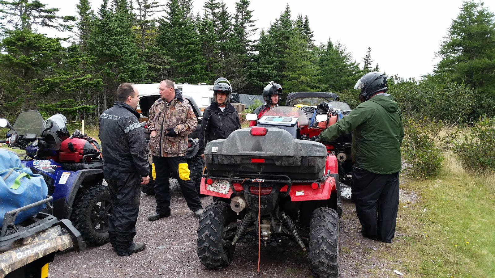
140ish kmThis day was the same as all the other years with one exception - we had a break down before we even started. Howie's Rincon wouldn't start. Unfortunately we couldn't get it started and Howie had to hire a flatbed tow truck to tow it to Simmons Honda in Gander. Howie rode with me in the side by side for the first two days until we could pick up his machine. It was an unexpected added expense for Howie but luckily he could still ride with me and and not miss any of the trip. This put us about 1.5 - 2 hours behind schedule but we still arrived in Clarenville at around 6 p.m. We just took a few less rest stops and drove a little faster.
 |
| Howie was working hard trying to get the Rincon going |
 |
| Trail side rest stop |

 |
| I guess I didn't attach Moosey very well. Once he got wet he wouldn't stay up. Pretty sad looking unit. |
 |
| Parked outside our rooms at St. Jude's Hotel |
 |
| Dinner at the restaurant attached to St. Jude's Hotel |
about 160km total driving
Normally about 143 but due to a detour we had to take around the Terra Nova bridge that's out it was about 160 km. The detour was no big deal and the trails around it were actually kind of fun. We had to do run a secondary highway for about 10 km and it was no problem as there was almost no traffic. Then we had to run about 20 km on dirt trails which was easy and then finally about another 6 km on the shoulder of the Provincial Highway. Luckily the traffic was not heavy. We just stayed to the should and drove about 60 kmh and had no problems.


 |
| This is in Terra Nova National Park. It's a beautiful spot near a nice waterfall. |


 |
| We stopped at the T'Railway Lounge in Gambo for a drink. |
 |
| There is a memorial site from a plane crash just outside Gander from 1967 right on the trail. Read more about it below. |

 |
| We stopped at Rosie's Restaurant in Gander for supper. It's right off the trail and the dinner was great as always. I ordered the turkey, which came with a lot of other things including salt beef, as you can see. |
Day 4 - Gander to Badger
about 205 km total driving. Trailblazers efficiency units was our destination in Badger.
Usually this about 140 km of riding but this year we did something different. We headed about 55 km inland (South) to a plane crash wreckage from the 1940's. It was very interesting to see and I would recommend it to anyone who hasn't seen it before. Some of the trails were narrow and grown in with brush but it was easy enough to get through especially since we had a GPS track to follow. When we left the wreckage we didn't head back to the T'Railway. We took a logging road West towards GrandFalls-Windsor then continued on along the railbed towards Badger. Here's a link to a website with information about the crash site
http://www.hiddennewfoundland.ca/sabena-airliner-crash.
http://www.hiddennewfoundland.ca/sabena-airliner-crash.
 |
| We stayed at the Comfort Inn in Gander. It was a nice spot. There was a gas station next to it that we were able to fill up at before heading back to the trail. |

 |
| We stopped at Wal Mart for some BBQ food before hitting the trail. |
 |
| We had to cross a rather large river to get to the plane crash site. It wasn't too deep luckily. There is another road you can take with a bridge. |

 |
| This is part of the goat path we took up to the plane crash site. You don't have to take it if you don't want. Just leave your machine on the main trail and walk up the rest of the way - about 400 meters.   |


 |
| After we left and got to a wider section of trail we stopped for a BBQ. |


 |
| On our way to Grand Falls-Windsor we took an old trail that was completely overgrown with alder brush. It was tough and slow going to find our way for a few kilometres. |
 |
| The sun was low in the sky and the trail was very dusty here. It was difficult to see sometimes. I rode with one hand on the wheel and one hand blocking the sun. |
 |
| This is where we stayed for the night. It's deceiving on the outside. It doesn't look like an efficiency unit but the place is great! Six rooms - three bathrooms, large living room and full kitchen, patio, and BBQ. Best of all it's right on the trail! |
 |
| After arriving in Badger we stopped at Badger Diner for their fish and chips. I can't recommend their fish and chips anymore as four guys in our group got sick after eating there on our 2017 trip. |
Day 5 - Badger to Lomond
200ish km total driving this day
The section we traveled from Badger to Deer Lake was the same as other years. This time we added another 45-50 km to head up to Lomond Lodge. We had to ride about 5 km on the shoulder of town roads in Deer Lake to get to the trail head then the trail was in good enough shape to ride about 50 km/h so it didn't take too long to get there. It was still just after dark when we got there though.


 |
| We stopped at a granite quarry which is located between Mary March Bridge and the Gaff. |
 |
| Why do people spray paint their names on things? Hey Ron, Marty, Olivia, John & Melissa - nobody cares you were there! Thanks for messing the place up with your graffiti. |


 |
| The top of the Gaff, about 1500 ft. It was REALLY windy up there this year. More so than normal. |


 |
| We stopped in Howley for a BBQ break. |


 |
| We cooked up some moose meat and vegetables that Dave from Trailblazers gave us. It was great! |


 |
| Other years we stop and camp here in Howley. This year we drove another 70+ km to get to Lomond! |

 |
| The Lomond Sinkhole is quite something to see. The water runs from a river and empties into a hole at the bottom. It just disappears into the ground. The pictures don't do it justice. We could go into the sinkhole as it was getting dark by the time we got there. So we went on to Lomond Lodge and returned to the Sinkhole the next morning. |


 |
| John was cutting up and cooking the onions. |


 |
| The Lomond Lodge buildings. We didn't even get to see them when we arrived because it was dark when we first arrived. |

Day 6 - Lomond to Corner Brook
about 185 km total driving.
We left Lomond, visited the sinkhole, and then drove North to Woody Point. Then we went to Cox's Cove and then onto Corner Brook. The trails all through here were fantastic, more like gravel roads. We saw many unlucky moose that were taken by hunters that day. We had to drive about 5 km on the shoulder of the highway when we came into Corner Brook via Hughe's Brook. See the map below.

 |
| We went down into the Sinkhole. It was very steep, the photos don't really give you the proper perspective of how steep it is. |


 |
| Although the weather was overcast the temperature was nice and there wasn't much dust on the trail at all. |
 |
| We stopped at a Can Am Dealer in Woody Point. No one bought a new machine! |


 |
| The Best Western - about 8 km south of Woody Point |
 |
| The first flat of 3 flats this trip. There were 3 flats total this trip, and John had them all, both on his rear tires. |

 |
| Getting gas in Cox's Cove |
 |
| Cox's Cove |


 |
| We weren't far from Corner Brook here. |
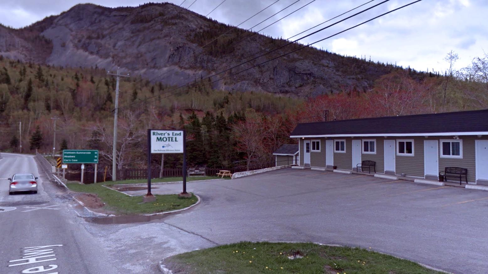 |
| None of us took a photo of the Motel, so I took this from Google Maps Street View. We came from the Mountain in the background and drove across that bridge you can see the grey Honda driving across. There is a corner store and gas station directly across the street, which is convenient. We ordered pizza for supper that night from Greco. |
Day 7 - Corner Brook to Robinson's
about 180 kms traveled this day total
We left the Motel & filled up with gas at the corner store directly across the street and got a coffee there as well. We didn't drive around town to go a restaurant as Corner Brook doesn't appear to be a very ATV friendly town like most other towns in NL seem to be. There is a trail almost across the street from the gas station shown by the orange line below. Click on the image to see a larger photo. Better yet look at the actual map on this link and zoom in as much as you want. We took the orange line but probably should have taken the light blue line in one spot. The orange trail was very rough in a few spots and I don't suggest you take it if you're a beginner. I would suggest getting trucked by Cecil Anderson, 709- 686- 5534, instead from your motel to the start of Logger School Road. We also had to drive along the shoulder of the highway for a bit but probably no more than 1 km total before getting to the red trail shown in the photo which takes you to the T'Railway. Most of that trail is in good condition. The last few km is rough but passable, just take your time.

 |
| Part of the goat trail around Corner Brook |

 |
| This is Serpentine Lake. Sometimes we camp here. This year we stayed at Motels and cabins each night. We had to stop by here anyway just because the lake and surrounding scenery is so beautiful. |


 |
| The lake water was very high this day. We usually camp in the section that is under water in the background near the tree line. |


 |
| A pub we stopped at in Gallants for a half hour or so. |


 |
| Our cabin at Pirate's Haven Campground. We love these cabins and their hot tub. We stay here every year. They have 3 cabins and each one has a full kitchen, 2 bedrooms with queen beds, patio's with BBQ's. One of the cabins has as washer and dryer as well. There is also a campground here if you would like to stay in tents instead of the cabins. |
 |
| The pub at Pirate's Haven |
Day 8 - Robinson's to Port Aux Basques
about 105 km without any side trips.This isn't a long day of traveling. We took our time and didn't leave until about 11 a.m. We stopped at the Sugarloaf Mountains for quite a while and then at a beach not far from the ferry terminal on our way back.
 |
| We stopped for gas first thing before we left. This gas station is just down the road from Pirate's Haven. Across the street from the station is a beautiful bluff we stopped at to take some pictures - seen below. |


 |
| We met a great group of guys from Ontario that crossed the island the same week we did. We ran into them several times. This was one of the bikes one of them used. I believe it was a 1984 Honda 250 4x2 with a solid rear axle. That guy earns my respect driving almost 1000 km on that machine! |


 |
| Stopping for a BBQ at Codroy Pond |


 |
| Cape Ray, not far from Port Aux Basques |

 |
| The top of Sugarloaf mountain, part of the Table Top Mountains. That's the Provincial Highway running between the mountains. |


 |
| Waiting to get our machines sprayed off before getting on the ferry. Some vehicles like ATV's get rinsed so you don't accidentally bring back some type of bug to the mainland that may affect agriculture. |
Day 9 - Ferry Day to Nova Scotia and Road Trip Home
The ferry from Port Aux Basques to North Sydney is about 6 hours and we generally arrive back in NS about 7:30 a.m.
 |
| The Nova Scotia crew (minus Bob who took the photo) and the Ontario crew. I thought we had a long ride home but the Ontario guys had about an 18 hour ride. |
Awesome looking trip. I admit I wish I could pull something like this together myself even if I went alone.
ReplyDeleteGet a few buddies together and plan it. You'll be happy you did!
Delete